
Walk a Napa Address Chain
A street-by-street search in Napa works best when one address becomes the control point for every later source. The first goal is not to label a household. It is to establish the parcel, jurisdiction, and record owner, then test each clue against a separate custodian. The APN links the parcel report to assessment, maps, deeds, and some permit files even when a street spelling, ZIP, or city boundary creates confusion.
Ownership and occupancy are different questions. A deed identifies parties to a transfer. The Assessor's mailing address shows where notices go. A reverse directory or census entry may identify an occupant in an earlier period. California voter records have their own access rules, so they cannot be treated as an open street list. This sequence keeps the Napa street directory grounded in records that can be checked.
- Address to GIS Parcel Report/APN. Enter the address in the Napa County GIS Parcel Report Tool, select the matching result, and save the APN and situs shown in the report.
- APN to the Assessor office record. Use the parcel number to ask the Napa County Assessor for the owner record, mailing address, and situs distinction. The web parcel tools do not provide a verified owner-name or address search.
- Owner to the Recorder name/date index. Search the Napa County Official Records index by the owner's name and a date range. Inspect the deed or other instrument through the counter or the paid image route before treating an indexed hit as proof.
- Address to eTRAKiT or PBES permits. After the GIS jurisdiction layer identifies the city or county path, search City eTRAKiT by address or use County PBES property retrieval. Permit contacts and applicants are clues about a project, not automatic proof of residence.
- Use voter records only through an allowed channel. My Voter Status is an authenticated self-lookup. A full voter file requires an approved election, scholarly, journalistic, political, or governmental purpose and does not create a casual by-street browse.
- Finish with older address evidence. Check a reverse or criss-cross directory, Sanborn sheets, and the public census range for occupants and changes to the structure. Compare the street address with the APN and legal description at every step.
Napa Address Records by Street
The Napa street directory is a chain of record sets rather than one county roster. Napa County GIS supplies the parcel key. The Assessor supplies an office route to ownership and mailing information. The Recorder supplies the transfer trail. City eTRAKiT and County PBES add work history, while historical collections add occupants and building context.
| Record Set | Keeper | What It Shows | Access |
|---|---|---|---|
| Parcel report/GIS | Napa County GIS/PBES | APN, situs, parcel shape, aerial, jurisdiction, environmental, and permit context | Free address/APN lookup |
| Assessment record | Napa County Assessor | Owner, mailing/situs, value, characteristics, and history | Office; no online owner/address search; data fees |
| Official record | Napa County Recorder-County Clerk | Grantor/grantee, document date and number, legal description, and transfer trail | Limited 1848-current index; subscription or counter images |
| Filed map | Recorder and County Surveyor | Subdivision, parcel, and survey geometry, book/page, and map number | Free index; $4/page image |
| Property tax | Napa County Tax Collector | Charges, special assessments, and paid or due status | Web search suppresses name and address |
| Building/planning | City eTRAKiT or County PBES by jurisdiction | Work, contacts, inspections, and chronology | Address search; older or copyrighted files may be office-only |
| Sanborn map | Historical collections | Footprint, material, use, stories, and changes | Historical Society or library access |
Read the columns as evidence with limits. The tax portal can confirm a charge or payment status but is not a people search because it deliberately hides both owner name and address. A permit contact can be an applicant, contractor, or professional. A historical address entry can predate the current parcel layout. These distinctions keep an address search from turning a narrow record into a broad claim.
Note: The APN is the safest bridge between Napa street wording, parcel boundaries, recorded documents, and older address references.
Napa GIS Parcel Search Fields
The County GIS Parcel Report Tool has two autocomplete routes. Begin with an address when the street number is known. Begin with a parcel number when a deed, map, or prior report already supplies the APN. The form pauses for matches, so a partial entry is a way to narrow the county list rather than a license to invent a parcel number.
| Field Label | Type | Required | Options / Format Notes |
|---|---|---|---|
| Address | autocomplete text | one of two | Begin with street number, pause for matches, add street letters |
| Parcel Number | autocomplete text | one of two | APN ultimately 12 digits without dashes; begin 3-6 digits and pause for list |
Button: Submit. From the main GIS viewer, choose I want to... and then Get Parcel Report. The viewer documents pan, zoom, annotation, sharing, JPG/PDF saving, and printed reports. A report groups aerial, environmental, boundary and jurisdiction, cultural, and county-permit information. It does not contain every source document, and not every layer is printable, so property questions still belong with the responsible department.
The APN behavior matters on a long street. An address search can return a stable parcel number even when the mailing city is broad or the physical land lies outside Napa's incorporated limits. The report also gives a jurisdiction clue before a user chooses City eTRAKiT or County PBES. PBES lists help at 707-253-4417, Monday through Friday, 8 a.m. to 5 p.m.
Browse Napa Streets Parcel by Parcel
To work down a Napa street, start with one known address and open the interactive parcel map. Pan along the road, zoom until the lot polygons separate, and click each parcel that touches the street. Record the APN and situs for each lot before moving to the next office. This produces a parcel-by-parcel research sheet without pretending that a map outline is a legal survey.
The ordinary viewer documents search, pan and zoom, annotation, sharing, and report creation. No verified public radius or buffer tool was found in the GIS viewer. When a street-wide or nearby-parcel question needs a defined data product, the Assessor's office lists a $29 buffer-zone option. That is an office fallback, not evidence that the public map has an automatic neighborhood button.
A simple process keeps the work in order: address → APN → parcel polygon → jurisdiction → owner record → deed or permit reference. Keep the original address beside the APN. A parcel may have a mailing address that differs from the physical situs, and a vacant unincorporated parcel may have no situs address at all.
Napa Assessor Owner and Mailing Trail
Napa's Assessor has an important online privacy quirk: there is no verified web search by owner name or address. Names and addresses remain public at the office, but the County does not post them online because state law protects specified officials' addresses and the County cannot reliably identify every protected owner. The public web parcel route is therefore APN-based.
Bring the APN to the Napa County Assessor at 1127 First Street, Suite A, Napa, or call 707-253-4467 during the office's Monday through Friday, 8 a.m. to 5 p.m. hours. The Assessor fee schedule lists assessment data with owner name and address at $18. Other listed routes include a $1 per-page screen print, a $4 AP map, a $29 buffer zone, and research at $135 per hour with a one-hour minimum. Choose the narrowest product that answers the street question.
Situs means the physical place of the parcel. Mailing address means where the owner receives notices and tax bills. It can point to a non-occupying owner, a trust or business mailing location, or a change after a transfer. Neither field alone proves who lives in the building. The Tax Collector's online payment page shows charges and status but suppresses both owner name and address, so it cannot replace the Assessor record.
Note: A Napa County assessment owner is a record relationship to land, while an occupant is a separate fact that needs a separate source.
Napa Recorder Deeds Since 1848
The Napa County Official Records index reaches from January 1, 1848 to the current record date. Its free public display is limited. A full index and document-image subscription covering 1848-current is listed at $4,316 per year, while counter research and copy service provide the practical alternative for a single parcel or deed. The online search asks for a full name in Last First Middle order, with optional From Date and To Date fields. Search spelling variants.
The index is a card-catalog-like guide, not the deed itself. Use the indexed name and date to locate the instrument, then check the grantor, grantee, recording number and date, legal description, APN when present, and prior-document references. A grantor is the party conveying an interest; a grantee is the party receiving it. A name match without the legal description can join the wrong parcel to the right person.
The County's filed-map search offers Location, Filed Map-Title, Filed Map-Book and Page, Assessor Map, and Corner Record modes. Map categories include Assessment Maps, Parcel Maps, Records of Survey, and Subdivision Maps. For an Assessor Map, the first three APN digits are the map book and the next two are the page. For example, APN 058-204-035 maps to 05820. Filed maps are $4 per page, and telephone credit-card orders add $7.
The Recorder-County Clerk fee schedule lists official-record copies at $2 per page and certification at $5 per document. Confirm the applicable schedule when ordering. Counter access is still the right fallback when the free index points to an old deed but the image gate blocks the detail needed to confirm a street parcel.
The official records search entrance illustrates the name-and-date route used before a deed image or counter copy is requested.
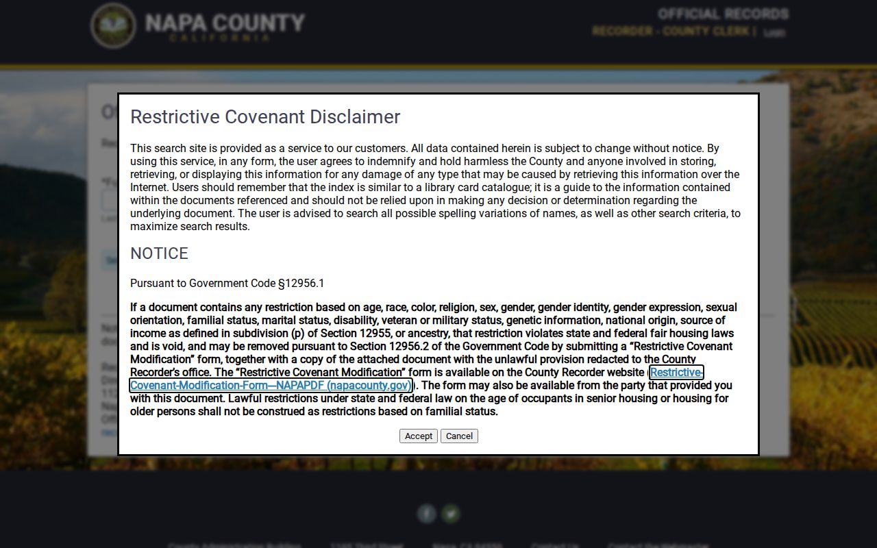
The index image belongs beside the APN and not in place of them. Use the Recorder-County Clerk at 1127 First Street, Suite A, Napa, for the underlying document or a certified copy.
Napa Permit History by Address
Once the parcel's jurisdiction is clear, City of Napa eTRAKiT can add current and historical building or planning activity. The permit search is free and uses Permit Number or Address. The County PBES route supplies scanned property records for the county path. The exact first year of eTRAKiT coverage is not published, so a result should not be described as a complete history.
| Field Label | Type | Required | Options / Format Notes |
|---|---|---|---|
| Search By | dropdown | yes | Permit Number; Address |
| Operator | dropdown | yes | Equals; At Least; At Most; Begins With; Contains (default) |
| search value | text | yes | Enter the permit number or address matching the selected mode |
Button: Search. Result controls include Print and Export to Excel. A selected permit has tabs for Permit Info, Site Info, Contacts, Fees, Inspections, Chronology, Conditions, and Reviews. These tabs can establish project dates, site details, named contacts, inspection sequence, fees, conditions, and review status. A contact may be an applicant, contractor, or professional rather than an owner or resident.
The City eTRAKiT property search shows the separate parcel/address path with map results and property tabs. The captured image is useful for seeing how a street query starts before a permit record is opened.
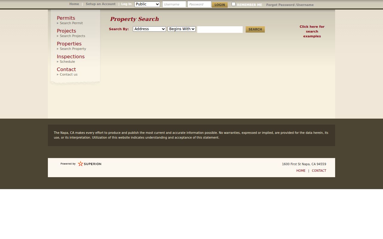
PBES reports that all property records are scanned into Electronic Document Retrieval, but some copyrighted material remains office-view only. Ask the responsible department for a permitted copy rather than treating a blocked download as a missing record.
Napa's Reverse Directory Trail
A reverse or criss-cross directory works in the opposite direction from a deed. It starts with a street and house number, then gives a listed occupant or business for the directory year. That makes it valuable for past households, but it does not show the present owner and does not prove that a listed person stayed at the address for the whole year. Compare adjacent volumes and copy the street-order entry exactly.
Napa County Historical Society's Goodman Library at 1219 First Street holds city directories, newspapers, maps, photographs, manuscripts, and genealogy material. The research library is open by appointment, with posted hours Tuesday through Thursday from 10 a.m. to 3 p.m. and Friday through Saturday from 10 a.m. to 5 p.m. In-person appointment research is free. Offsite research is listed at $50 per hour prepaid, or $20 per hour for nonprofit requests when available, with ordinary reports taking about four weeks.
NCHS recommends quotation marks, plus signs between concepts, spelling variants, and historic place names in CatalogIt. A building photo may be indexed under a former or common name instead of the current street address, so search both forms. Napa Valley Genealogical Society provides another in-person, noncirculating route, with local census, voter, funeral-home, cemetery, yearbook, church, map, and family holdings, plus more than 100 microfilm and microfiche rolls.
The broader historical run and how to read each directory belongs with the Napa Directory Book collections. For a street search, the key point is the address-to-occupant reversal and the gap in the verified local run. No complete public list of Napa reverse-directory publishers and years was confirmed.
Note: A criss-cross result is a historical address clue, so pair it with a deed, map, census line, or newspaper rather than repeating it as a current roster.
Napa ZIPs and City Jurisdiction
ZIP code is a mailing answer, not a boundary survey. Napa's two verified postal ZIPs have different broad patterns. 94558 covers a wide northern and western mailing area, including places beyond the city boundary, and is associated with the Napa Main station at 1625 Trancas Street. 94559 covers downtown, central, eastern, and southern mailing areas, with Franklin at 1436 Second Street and Wine Valley at 820 Randolph. Individual USPS verification still controls a particular address.
Use the USPS facility information or city/state ZIP lookup for mail format. Use the County GIS and Assessor for situs and APN. Use the City limits and Rural Urban Limit GIS layer for jurisdiction. A Napa ZIP, or even City water service, does not prove incorporation. Napa State Hospital is an example of service outside city or sphere areas.
That mismatch matters for a Napa street directory. An address can carry a Napa mailing city while county records control permits, assessment, or planning. Check the boundary layer before choosing City eTRAKiT, County PBES, or a City public-records request. No verified local portal supplies a ZIP-wide owner roll, so do not infer one from a search form that accepts only an address or APN.
Historic Napa Address Crosswalks
Older Napa streets can be matched more safely through a crosswalk than through a modern address alone. City historic-inventory PDFs combine APN, current or alternate address, building name, date, and documentary source. The Napa Historic Resources Field Guide also explains that older paper building permits can be retrieved with an address and APN. A former building name may be the best entry point when a street label has changed.
A plat is a recorded map that lays out parcels, streets, lots, or easements. Pair the plat with the legal description, sequential Sanborn maps, directory street sections, and the GIS parcel shape. Early-1950s county subdivisions around Old Sonoma Road, Pueblo Park, Sierra Avenue, Monticello Park, Alta Heights, and Shetler created lasting city and county ambiguity. Napa Pipe's 151-acre annexation in 2014 is a later jurisdiction shift.
- Parcel
- A mapped unit of land identified by an APN. The parcel is the land record anchor, not a list of everyone present there.
- Situs
- The physical location of the parcel. A vacant unincorporated parcel may have no situs address.
- Plat
- A recorded map that shows how land was divided and how streets, lots, or related features were laid out.
- Criss-cross directory
- A reverse directory section arranged by street and house number, used to find a listed historical occupant or business.
Research did not locate an authoritative citywide renumbering history, grid formula, quadrant system, or renamed-street chronology for Napa. Preserve that gap. When an old number does not match, use APN, plat, legal description, historic inventory, and the Sanborn sequence instead of guessing.
Napa Sanborn Maps by Street
Sanborn sheets add a physical layer to a street directory. Napa's verified sequence includes 1886 with seven sheets, 1891 with twenty-two sheets, and later references for 1901, 1910, 1924, and 1949. Footprints, materials, stories, windows, additions, and changes in use can show whether an address points to the same structure across time. A map cannot name every occupant, but it can test whether an address trail is physically plausible.
The Library of Congress Napa Sanborn collection provides free access to early map material. Later access runs through the Napa County Historical Society, California State Library, or related research partners. View the street, block, lot shape, and building footprint together with the APN and legal description. A moved, replaced, or enlarged building can explain why a directory address and a modern parcel do not align cleanly.
For the people layer, the federal census is public for 1850 through 1950 under the 72-year rule. Napa's mostly destroyed 1890 federal census is a major gap. Great Registers from 1880-1894 and 1908-1956, tax assessments from 1884-1893, the 1885-1886 directory, deeds, and newspapers can bridge the missing decade. Napa County was formed in 1850, Napa incorporated in 1872 and reincorporated in 1874, and the Recorder's online history reaches back to 1848, so the local record trail has deep but uneven roots.
Use Sanborn, census, Great Register, and directory evidence as separate layers. A missing name can mean a move, death, nonpublication, variant spelling, or a listing under another adult. The safest street directory conclusion is the one that states which layer supplied each fact.
Note: The 1890 census loss is a Napa research gap, not a reason to fill an address history with an unverified occupant.
Napa Street Directory Limits
A Napa street directory cannot reveal every person connected to an address. The parcel chain centers on assessed ownership and land description. The reverse directory and census are historical. Utility and delivery customer information is not part of the public parcel trail. DMV residence and motor-vehicle records are limited by the federal Driver's Privacy Protection Act and California rules. Confidential voters and Safe at Home participants may be absent by design.
Voter access is especially narrow. My Voter Status authenticates the person using it. A full voter file may contain registration addresses only for approved purposes under California Elections Code restrictions, and confidential voters are excluded. There is no lawful general-purpose public tool that displays every voter on a Napa block. Court, vital, adoption, sealed, juvenile, and other protected records have their own limits as well.
Lawful personal use. Napa County records are available for personal, lawful research, family history, property history, and civic questions. Public availability does not permit stalking, harassment, intimidation, or harm; California Penal Code section 646.9 addresses willful and malicious repeated following or harassment with a credible threat causing reasonable fear.
Verify a disputed fact with the office that created the record. The Assessor handles assessment ownership questions, the Recorder handles recorded instruments, Elections handles voter records, and City or County departments handle their own permit and planning files. When the question narrows from a whole street to one person, use the Napa resident lookup workflow and keep independent sources separate.